


One of the most powerful, inspiring Geography resources is also completely free. John Dabell examines how teachers can make the most of it..
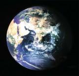
People used to believe the world was flat. We can laugh at that now. Some people believe that geography teaching today is flat too. That’s something we can’t snigger at. There is no excuse now for handing out tatty old atlases one between two pupils and looking at the world in 2D. Google Earth - and Google Maps - have changed the landscape forever and offer us a delicious array of activities to get our teeth into. Google Earth has so many features that it’s hard to keep track of all its capabilities. Some of the features are almost hidden and others require some developer skills to implement but they are there for the taking.
Forget ‘turn to page 49 everyone’. Searching in Google Earth is far more efficient and no different from using a normal search engine. To pinpoint a location anywhere in the world you can enter one of the following:
• the name of the country or major town
• town and country for smaller towns
• full address
• postcode
 One of the first things that children want to do when they fire up Google Earth is to find where they live. So type the place you are looking for in the search box and press ‘enter’. The search result will be marked by a grey cross hair.
Many teachers give children a capital city to remember as part of their morning registration routine, saying their name, the capital city and the country. Google Earth makes this a tad more exciting. Over a period of days and weeks, children can now take it in turns to type in their capital city for everyone to see on the interactive whiteboard.
You can develop this idea into a starter activity for your geography lessons by playing ‘Where in the world am I?’. Children have to guess where you are by asking questions such as ‘Are you in Europe?’, ‘Are you in a city?’, ‘Are you inland?’ and so on. This encourages children to pose their own geographical questions, use Google Earth and work together to find your mystery location. When you have been ‘uncovered’, the game passes to someone else who has to be found in as few questions as possible.
So, your favourite pizza place offers ‘free local delivery’ does it? It sounds generous enough, but what is your pizza’s true carbon footprint? Let Google Earth help you find out.
Using Google Earth, you can navigate your way to every ingredient’s country of origin and work out how far it has to travel to reach the UK. By adding the distances together you can calculate the pizza’s total ‘food miles’. For example:
• Flour – North America, 5,400 miles
• Tomatoes and Mozzarella – Italy, 1,000 miles
• Black pepper – India, 5,000 miles
• Tuna fish – Mauritius, 5,600 miles
• Pineapples – Kenya, 4,500 miles
• Peppers – Holland, 400 miles
• Mushrooms – UK, 200 miles
Why not share the horror of this 22,100 mile trip with everyone in a class assembly, projecting Google Earth on to a whiteboard and flying each ingredient into the school canteen? Try doing this activity for any food product with multiple ingredients, such as ice cream, canned vegetable soup and meal deals.
Try linking area and perimeter to highlight the problem of congestion in some of our major cities. You can use the measurement tool in Google Earth to discover the dimensions of different buildings and parks and then play fantasy planners.
For example, measure the area taken up by Buckingham Palace. If we knocked it down, would that solve the congestion problems in London? What about paving Hyde Park? Encourage children to ‘fly’ between places, see how much land they occupy and whether there are any vacant pieces of land they could build on.
 Google Earth allows you to add a ‘placemark’ to sites of interest, which are then added to the ‘My Places’ folder for easy reference later on. Placemarks show up on the map as yellow drawing pins, but it’s possible to customise the icon. http://gelessons.com suggests swapping the pins for a Flat Stanley graphic. This will allow you to post Stanley around the world and spur writing and literacy. Children could write about his adventures meeting Barack Obama in Washington D.C, or he might become stranded on a remote island…
To do this, create a placemark on your chosen location. A new window will pop up and you will need to click on the yellow drawing pin that appears in a small grey box to the right of the ‘name’ field. Having done this, you can then select the ‘add custom icon button’, and paste in the following URL: http://gelessons.com/graphics/flatstanleyicon .gif. Now you can send Flat Stanley anywhere on the planet!
 Use Google Earth to find a proposed wind farm development and decide where you would put a collection of turbines. Explore different environments in the UK using satellite technology then use ‘placemarks’ to highlight your ideal locations. Children could take screenshot images and debate the pros and cons of developing in a particular area.
Google Earth is an out of this world application for teaching geography and a superb programme for souping up other subjects across the curriculum. This virtual globe, map and geographic information gem is a free, easy and exciting way to get children more worldly wise and turn them into true global citizens. Using ICT to enhance teaching and learning in geography has never had a better friend than Google Earth. The whole world really is in your hands.
Wow children with Google Earth
1. View old images of the earth
Explore the past and see how locations have changed over time. To do this, click the ‘Historical Imagery’ button in the toolbar. Move the slider at the top left corner of the 3D viewer to see imagery from previous eras.
2. Examine photo-realistic buildings
You can get a detailed look at hundreds of buildings in many of the world’s cities by ticking the ‘3D buildings’ option in the ‘Layers’ panel. Tilt or zoom in to get a better view.
3. Watch the sunrise
Click on the daylight button and use the time slider to watch dusk, dawn and shadows move across the Earth.
4. Take to the skies
Fly around the world using a flight simulator. Go to ‘Tools’, enter ‘Flight Simulator’ and select your plane and start location. The display shows your speed in knots, heading, throttle and altitude.
5. Explore the sea bed
The latest version of Google Earth lets you dive into the seas and marvel at underwater terrain and investigate hundreds of shipwrecks.
Google Earth can be downloaded for free at http://earth.google.com
To learn more about how to use the different Google Earth tools, visit http://www.geographyteachingtoday.org.uk/ks3-resources/curriculumopportunities/using-google-earth/


Power Maths – A Child-Centred, ‘Can-Do’ Mastery Teaching Programme for KS1 and KS2
Category: Maths

Fit To Dance Schools From Disney On Ice
Category: Other

‘S!ng Sensational’ And ‘A King Is Born’ – Two Fun New Musical Masterpieces That Children Will Love
Category: Music
Product review: Schofield & Sims Fractions, Decimals & Percentages
Category: Maths

Kindness is contagious - give your colleagues a boost by recognising their efforts
Ace-Classroom-Support

Behaviour management: choosing the right words
Behaviour Management


